Bridge Over The Legal Divide
Unholy Alliances
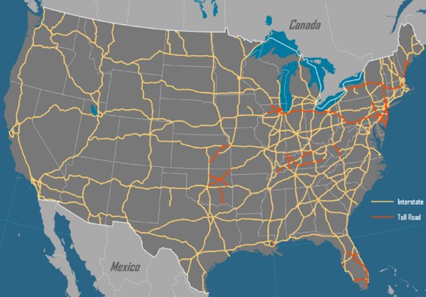
The system of roads that we call the Interstate is a transcontinental roads system. It was named the Dwight D. Eisenhower National System of Interstate and Defense Highways. The following is an excerpt from the AASHTO Interstate Highway History timeline:
June 29, 1956, President Dwight D. Eisenhower signed for the Federal-Aid Highway Act of 1956. Title I increased the system's proposed length to 41,000 miles; nationwide design standards developed through AASHTO (A Policy on Design Standards: Interstate System); established a new method for apportioning funds among states and set federal government's share of the project cost at 90 percent. Title II—the Highway Revenue Act of 1956—created the Highway Trust Fund as a dedicated source of funding for the Interstate Highway System, on a pay-as-you-go basis through the federal gas tax and other motor-vehicle user fees. AASHTO History
Source:
Hofstra University, Geography of Transport Systems
The history of roads actually began in 1919 when the Army sent a convoy from Washington DC to San Francisco to determine how long it would take and how difficult it would be. It took from 1919 to 1956 to get a national road system authorized and funded. The way it was accomplished was to put the highway system under the umbrella of defense of the nation. Ike's Interstates at 50
While the public calls our road system, the
Interstate Highway System, the military calls their strategic defense system of
roads, STRAHNET. They are actually the same roads, just different names to
reflect the different purposes.
Strategic Highway Network
Recall that the The Intermodal Surface Transportation Efficiency Act of 1991 was discussed in Fusion Centers Part One. The following is an excerpt from the Department of Defense DOD STRAHNET Guide.
"The Intermodal Surface Transportation Efficiency Act of 1991 and the National Highway System Designation Act of 1995 provided for inclusion of STRAHNET and important STRAHNET Connectors in the 160,955-mile National Highway System (NHS). The primary Connector routes for the Priority 1 and 2 installations and ports are included in the NHS. Federal oversight will ensure optimum maintenance levels for the NHS, thus assuring that the roads can support an emergency deployment. With DOD’s current emphasis on continental US-based military units, the NHS will play an increasingly important role in new deployment scenarios."
As the Department of Defense (DOD) designated agent for public highway matters, the Military Surface Deployment and Distribution Command Transportation Engineering Agency (formerly Military Traffic Management Command Transportation Engineering Agency (MTMCTEA)) is the proponent for STRAHNET and STRAHNET Connectors. SDDCTEA identified STRAHNET and the Connector routes in coordination with the Federal Highway Administration (FHWA), the State transportation departments, the military Services and installations, and the ports. Together, STRAHNET and the Connectors define the total minimum defense public highway network needed to support a defense emergency.
Strategic Highway Network (STRAHNET) and STRAHNET Connectors
"The Strategic Highway Network (STRAHNET) is critical to the Department of Defense's (DoD's) domestic operations. The STRAHNET is a 62,791-mile system of roads deemed necessary for emergency mobilization and peacetime movement of heavy armor, fuel, ammunition, repair parts, food, and other commodities to support U.S. military operations. Even though DoD primarily deploys heavy equipment by rail, highways play a critical role.The Surface Deployment and Distribution Command Transportation Engineering Agency (SDDCTEA) is the DoD designated agent for public highway matters, including STRAHNET and STRAHNET Connectors. The SDDCTEA identified STRAHNET and the Connector routes in coordination with the Federal Highway Administration (FHWA), the State transportation departments, the military Services and installations, and the ports. Together, STRAHNET and the Connectors define the total minimum defense public highway network needed to support a defense emergency."
Keyword in the above is EMERGENCY
The National Highway
System
Backbone of our National
"On December 9, 1993, at Union Station in Washington, D.C., U.S. DOT Secretary Federico Peña and FHWA Administrator Slater announced the submission of the National Highway System (NHS) plan to Congress. Peña also outlined his principles and goals for a National Transportation System (NTS)."
"Union Station serves as a fitting backdrop for the unveiling of the National Highway System," said Slater. "Just outside the station, Louisiana Avenue is part of the National Highway System -- demonstrating how the National Highway System can provide links among the many modes that make up our transportation network. In fact, the National Highway System enhances the other modes by linking them.
....
"A comprehensive National
Transportation System will help us meet the challenges of
the 21st century global economy by enhancing all our
different modes of transportation and their links --
increasing the efficiency and productivity of our nation,"
Peña said.
NTS will incorporate from all the modes the most significant
elements of the nation's transportation systems. Beginning
with NHS, NTS will include airports, ports, waterways, rail,
intercity bus lines, pipelines, and local transit systems
with regional and national impact. NTS will also include
systems moving both people and freight as well as facilities
owned by both private business and the public sector.
NHS is the core of the future NTS.
Slater explained NHS in detail:
"The first component of the
proposed National Highway System is the 45,000-mile
interstate system, which accounts for nearly 30 percent of
the proposed system mileage.
"The second component includes 21 congressionally designated
high-priority corridors as identified in the ISTEA. These
corridors total 4,500 miles.
"The third component is the non-interstate portion of the
Strategic Highway Corridor Network (STRAHNET), identified by
the Department of Defense in cooperation with the Department
of Transportation. It totals about 15,700 miles. Based on
the most recent information, including plans for base
closures, these corridors and the interstate system have
been identified by the Department of Defense as the most
critical highway links in our transportation system. As we
found during Desert Storm, highway mobility is essential to
our national defense by giving us the ability to move troops
and equipment to airports, to ports, to rail lines, and to
other bases for rapid deployment.
"The fourth component is major Strategic Highway Corridor
Network connectors. They consist of 1,900 miles of roads
linking major military installations and other
defense-related facilities to the STRAHNET corridors.
"Collectively, these four components -- all specifically
required by ISTEA -- account for 67,500 miles or roughly 43
percent of the proposed system.
"The remainder of the proposed system -- totalling 91,000
miles -- is made up of other important arterial highways
that serve interstate and interregional travel and that
provide connections to major ports, airports, public
transportation facilities, and other intermodal facilities
...
"The National Highway System will also strengthen our links with Canada and Mexico, especially by providing some of the vitally needed north-south connectors. Today, even before NAFTA (North American Free Trade Agreement) goes into effect, trucks carry about 80 percent of freight shipments between the United States and Mexico and about 60 percent

Dot Secretary
Federico Peña
Jan. 1993 - Feb. 1997
Federico's Folly (Denver Airport) By Michael Fumento, American Spectator

Federal Highway Administrator
Rodney E. Slater - Jan 1993 - Feb 1997
Dot Secretary Feb. 1997 - Jan. 2001
National Intelligent
Vehicle Highway System
(National Highway System)
Program Plan
Report to Congress
"America’s economic future depends on the Nation’s capacity to invent and master new technologies. It depends upon moving ideas to the marketplace to spur growth, create new jobs, and strengthen our industrial performance. Vice President Gore has identified broad initiatives that together will restore America’s technological leadership and reinvigorate our economy. The Vice President’s technology initiative emphasizes that investing in infrastructure means more than building and repairing bridges, harbors, and highways. Today the United States faces a new series of communications, transportation, and environmental needs for the 21st century."
"The Department of Transportation’s (DOT) Intelligent Vehicle Highway Systems (IVHS) program is a key component in this national technology initiative. IVHS will harness emerging communications. computer, and surveillance technologies to address our most challenging surface transportation problems. Early indications are that IVHS applications can improve traffic flow in congested urban corridors, provide safer and more secure travel, reduce the harmful environmental impacts of traffic congestion, and help American travelers and businesses achieve new levels of productivity.
.... Defense Technology Conversion
The United States is the world leader in many
technologies applicable to
IVHS, and numerous efforts are currently underway to assess
the feasibility
of converting existing aerospace and defense technologies to
IVHS. For
example, DOT and the Department of Energy (DOE) entered into
a
Memorandum of Understanding on August 6, 1993, that will
promote the use
of the defense technology expertise of DOE’s national
laboratories in DOT’s
IVHS program.

U.S. Secretary of Energy
Hazel O'Leary
Jan. 1993 - Dec. 1997
Discussions have also taken place between DOT and various elements of the Department of Defense (DOD) and the Advanced Research Projects Agency (ARPA) to convert applicable defense technologies to IVHS. Potentially applicable technologies include: high-definition imaging and displays, advanced sensors (e.g., infrared, microwave, acoustic), radar/lidar technologies, simulation modeling, telecommunications, advanced software (e.g., systems control, image processing, and data infusion), artificial intelligence technologtes, and vehicle robotics and location systems.
The GPS system. with its network of satellites, IS already a component of many IVHS systems. DOT has been identified to work closely with DOD to facilitate the proper implementation of GPS for civilian use, and to ensure the long-term availability of GPS as a U.S. national asset that would be available to civilian users worldwtde.
The defense industry already recognizes the potential of the IVHS program, and some 50 defense organizations are members of IVHS AMERICA, including ARPA, the U.S. Tank and Automotive Command (TACOM), Martin Marietta, and Hughes Aircraft, In addition, over 20 defense community contractors are participating in the AI-IS Precursor Systems Analyses studies and ten defense contractors are involved in the development of the national IVHS system architecture. Continued utilization of the resources represented by the defense and aerospace industry will be instrumental in advancing the national IVHS program and bringing IVHS systems to deployment."
Partnership Between DOJ and DOD

Janet Reno, Attorney General
March 1993 - January 2001

John Deutch, Deputy Secretary of
Defense
1994 - 1995
1994 - NCJ 164268 - "Partnership" Between Law Enforcement and the Military
"In 1994 the U.S. Department of Justice (DOJ) and the U.S. Department of Defense (DOD) entered into a cooperative agreement to develop technologies of value to both. This agreement, codified in a Memorandum of Understanding (MOU) and signed by the Deputy Secretary of Defense and the Attorney General, formalized and focused a longstanding ad hoc relationship. To manage this technology development program and to direct its day-to-day activities, the MOU established a Joint Program Steering Group (JPSG) that would represent both departments and be staffed with members from several agencies."
[MOU Source: "The Development of 'Non-Lethal' Weapons During The 1990's" footnote 26. Researcher Amanda Teegarden, OK-Safe]
Warrior Cops: The Omnious Growth of Paramilitarism in American Police Departments
Rand: "Seeking Nontraditional Approaches to Collaborating and PARTNERING with Industry"
Civilian-Military Integration
Assessing the Potential for Civil-Military Integration:
Technologies, Processes, and Practices
September 1994, OTA-ISS-611
Excerpt p. 14-15: (emphasis added)
DEFINING CMI
Definitions are essential--not
only for the term "civil-military integration,"
but also for the various related activities, such as
"commercial goods" and "commercial services." Policy
formulation for CMI has been handicapped by the lack of a
standard definition of CMI. OTA developed a working
definition of CMI (see chapter 3), and definitions of
commercial goods and services (see chapter 4).
In this study, Civil-Military Integration (CMI) is
defined as the process of uniting the Defense Technology and
Industrial Base (DTIB) and the larger Commercial Technology
and Industrial Base (CTIB) into a unified National
Technology and Industrial Base (NTIB). Under CMI, common
technologies, processes, labor, equipment, material, and/or
facilities would be used to meet both defense and commercial
needs.